
Ages of watermanegement in the Hargerpolder
Linda Koopman | Noord0Holland, Netherlands
Photographer: Linda Koopman
Exhibit Title: Ages of watermanegement in the Hargerpolder
Location: Noord0Holland, Netherlands
The Hargerpolder is not a polder in the way it is a reclaimed lake. After strong floods washed away the natural dunes in 1421, people constructed wooden pallisades, later a dam of wood and clay and in the 19th century a dyke of clay and stones, called the 'Hondsbossche zeewering', to keep the Noordzee out. The Schoolse zeedijk in the north and the Slaperdijk in the east date from 1230 and 1526.
The required clay for these dykes was mined in the polder itself, leaving 'de Putten', 'Verdolven landen' and a canal, now important nature reserves with special vegetation and lots of (migratory) birds. Bacause of the slight salty soil the Hargerpolder is only suitable for livestock farming.
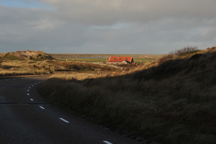
In medieval times people raised the banks of the many creeks, the reason why these small roads are meandering through the polder.
Because of climate change artificial dunes on the seaside of the dyke have been constructed in 2014. The northern part of the polder, the Leipolder, has been transformed into a water storage facility.
My photoseries tell about how people created the landscape of Noord-Holland, a part of the Netherlands, situated beneath sealevel.
In archives and on old maps I am searching for their efforts to keep their loved ones, home, cattle and harvest protected from the sea by working the land.
It is a never ending story and because of climate change new works have been planned and done in this region.
This photoserie is about the Hargerpolder, a piece of the original landscape, that has been saved after floods in medieval times
lc.koopman@hetnet.nl
Make Comment/View Comments


